


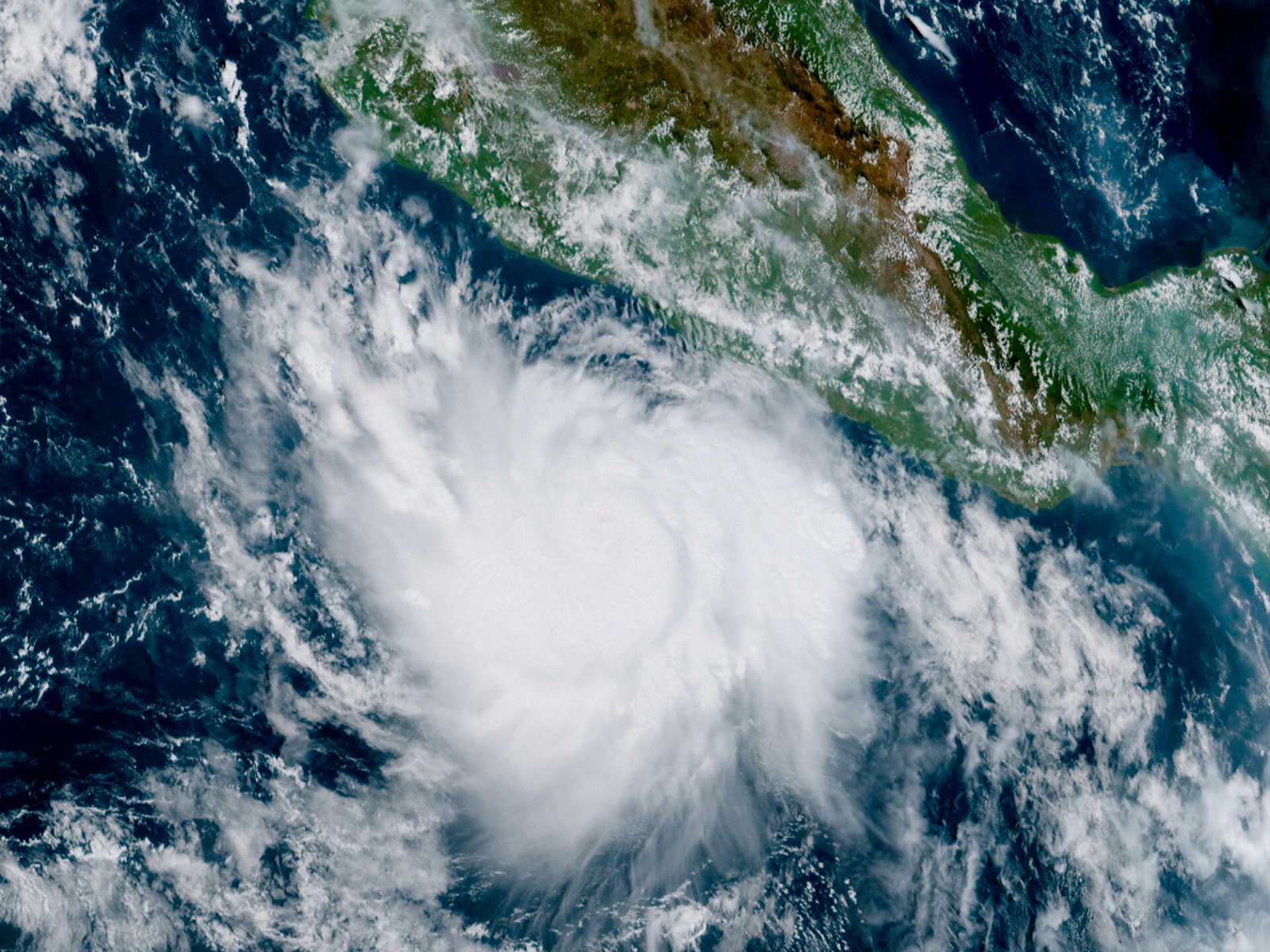
Hurricane Polo has rapidly intensified into a Category 5 storm in the Pacific Ocean off Mexico, with maximum sustained winds of 165mph (270km/h), according to the US National Hurricane Center.
The storm was centred about 215 miles (345km) south of Zihuatanejo in Guerrero state on Tuesday, moving slowly north. Forecasters said its core was expected to remain offshore, but warned that the system could still bring dangerous conditions to parts of south-western Mexico.
Polo intensifies in less than a day
Polo had been a tropical storm on Monday, with winds below hurricane strength. Within less than 24 hours, it strengthened into a Category 5 hurricane, the highest level on the Saffir-Simpson Hurricane Wind Scale.
The National Hurricane Center described Polo as an extremely dangerous hurricane. Its advisory said some additional strengthening was possible, although fluctuations in strength were also expected. Hurricane-force winds extended up to about 35 miles (55km) from the centre, while tropical-storm-force winds reached as far as 90 miles (150km).
Mexico had issued a tropical storm warning for part of the south-western coast, including areas between Tecpan de Galeana and Punta San Telmo. Forecasters warned that heavy rain could lead to life-threatening flooding and mudslides inland, while coastal communities could face dangerous surf and rip currents.
El Niño linked to active Pacific season
The rapid strengthening is occurring as a strong El Niño pattern influences the Pacific. El Niño develops when ocean temperatures in parts of the central and eastern tropical Pacific become warmer than their historical average, changing atmospheric conditions around the world.
Meteorologists say El Niño can suppress some of the conditions that support hurricane development in the Atlantic while favouring greater activity in parts of the Pacific. The 2026 Pacific season has already produced 18 named storms and seven hurricanes, according to the information cited by the National Hurricane Center and the Guardian report.
The Atlantic has had a much quieter season. By 21 September, it had recorded six named tropical storms but no hurricanes. The lack of an Atlantic hurricane by that point was described in the Guardian report as the first such occurrence in 112 years.
Mexico remains under weather threat
Although Polo was forecast to remain offshore, the distance from land does not remove the risk. Heavy rainfall can cause flooding and mudslides away from a hurricane’s centre, while large waves and strong currents can create dangerous conditions along the coast.
The National Hurricane Center said Polo was expected to move slowly near the coast of south-western Mexico over the following days, with the storm forecast to turn towards the northwest and west-northwest. The exact track and intensity remained subject to change.
Polo is the 18th named storm and seventh hurricane of the 2026 Pacific hurricane season, which runs from 15 May to 30 November. The Atlantic hurricane season runs from June through November.
For communities near the affected coastline, the immediate concerns are flooding, mudslides, high surf and strong winds rather than a direct landfall. Residents in areas covered by official warnings should continue to follow instructions from Mexican authorities and local emergency services as the forecast develops.
Source: The Guardian
