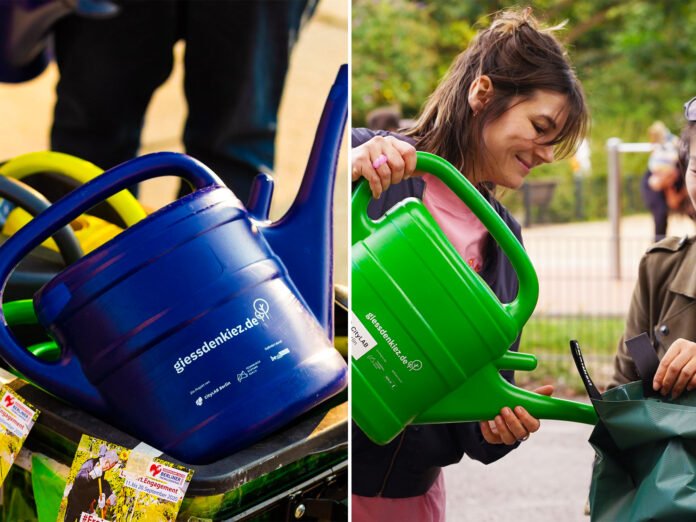
A Berlin digital platform is helping residents coordinate the watering of street trees as hotter and drier summers place growing pressure on the city’s urban greenery.
Gieß den Kiez, which translates roughly as “water your neighbourhood”, uses an interactive map to show trees across Berlin and estimate their watering needs. Residents can check when a tree was last watered, record their own watering and adopt individual trees for ongoing care.
How the Berlin tree map works
The platform, run by CityLAB Berlin since 2020, combines tree-register information with weather data to help residents identify trees that may need attention. Colour coding highlights trees according to their watering status, while information about species, age and recent rainfall helps users understand why some trees need more water than others.
CityLAB Berlin says its current platform covers more than 900,000 trees. Its 2026 project information also describes the system as open source, meaning other cities with suitable tree data can adapt the technology for their own communities.
The approach is particularly useful for younger trees, which have smaller root systems and can be more vulnerable during prolonged dry periods. Residents can also use the platform to find public water pumps and guidance on watering techniques.
Volunteers complement city services
The project has attracted about 12,000 active users, according to CityLAB Berlin. Their work complements municipal crews that already water thousands of trees but can face difficulty keeping pace during periods of extreme heat.
The platform’s organisers say participation tends to increase during heatwaves. On 27 June 2026, when Berlin recorded a temperature of 39.9C, volunteers logged about 8,000 litres of water being used on trees across the city, according to the Guardian.
Urban trees can provide shade and help cool built-up areas, while also contributing to biodiversity, air quality and stormwater management. Urban forestry specialists increasingly describe mature trees as important parts of city infrastructure rather than simply decorative features.
For Australia, where cities also experience heatwaves, drought and pressure on urban vegetation, the idea illustrates how digital mapping and community participation can be combined with existing council services. Australia By Aussie has also reported on community interest in protecting significant trees, including nine trees shortlisted for Victoria’s Tree of the Year.
A model other cities can adapt
Gieß den Kiez is designed so the underlying code can be reused by other cities that maintain suitable public tree data. CityLAB Berlin says versions inspired by the platform are already operating in several German locations and in Paris.
The project does not replace professional urban forestry or municipal watering programmes. Instead, it gives residents a way to see where help may be needed and record what has already been done, reducing the risk of people watering the same tree while another nearby tree is overlooked.
As heatwaves place increasing stress on urban greenery, the Berlin project shows how relatively simple digital tools can turn local environmental action into a coordinated community effort.
Sources: The Guardian; CityLAB Berlin.